

Overview
New York City is preparing to release the updated 2024 version of its Hazard Mitigation Plan (HMP). This is the City’s guide to preparing for potential emergencies and working to reduce their impact on the people, built environment, and economy of New York.
The Federal Emergency Management Agency (FEMA) requires a Hazard Mitigation Plan in order to be eligible to receive Hazard Mitigation Assistance funding, and there are localized versions created by states, regions, and municipalities across the country. Among these, New York City announced their first HMP in 2009. The NYC HMP is not a policy document or enforceable requirement; it’s merely a guide to help the City prepare for and reduce its exposure to possible future events. The entire plan is updated every five years, although adjustments can be made should information in it change, and the online format allows for a more accessible, interactive document that is easier to keep relevant to the City’s needs.
The HMP serves to educate and prepare the numerous organizations and people on the responding side as well as the public for whom it is intended as a resource.
Besides avoiding the futile cycle of simply responding to and recovering from repeated disasters, shifting emphasis to mitigation is also more cost-effective. New York City Emergency Management (NYCEM) notes that it is estimated that every dollar spent on mitigation helps save approximately six dollars in long-term recovery costs. Most importantly, mitigation reduces the potential for danger and suffering faced by residents.
Because the HMP is a very large document (about 600 pages for the printed 2019 version) created for emergency management professionals, the City also produces a smaller (about 150 printed pages), more layman-friendly version called the Risk Landscape, for residents, community groups, and other partners and stakeholders. NYC announced its first HMP in 2009 and was a leader in putting their HMP online, starting with the first updated version in 2014. The 2019 HMP is available here and the Risk Landscape here. The 2019 and earlier versions are also available through links found here.
Almost 200 participants worked to produce the new version of the HMP, representing dozens of government agencies, community-based organizations, private-sector business interests, cultural institutions, and academia, along with input from the general public. Each of these are stakeholders who play a vital role in preparedness and response. Beyond creating consensus on issues and approaches, one benefit of their participation in creating the HMP is the process also allows for the creation and reinforcement of working relationships among the participants – relationships critical to effective disaster response that experience shows can make the difference between successfully meeting challenges in an emergency situation and failing to act effectively when it matters most.
Structure
The HMP begins with two sections explaining what it is, why it was created, and who created it.
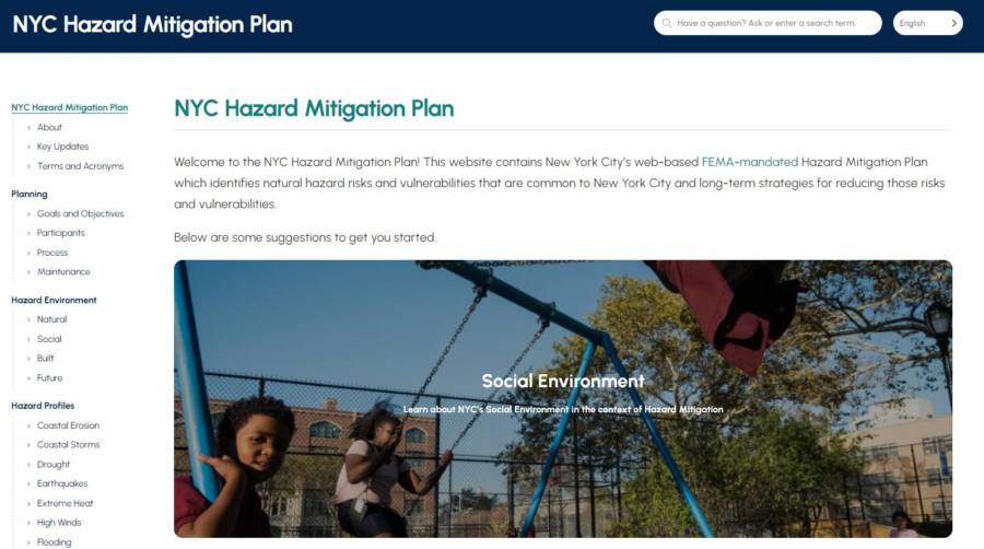
Then, the Hazard Environment section details the city from the perspectives of its natural, social, built, and future circumstances, laying out the factors and conditions that shape planning and must be addressed by it.
Next, the Hazard Profiles section lists the principal categories of dangers facing the city. The 2024 plan includes:
・Coastal Erosion
・Coastal Storms
・Drought
・Earthquakes
・Extreme Heat
・High Winds
・Flooding
・Poor Air Quality
・Winter Weather
・Non-Natural
Many of these have remained constant over the years, but a few come and go, usually being broken out from or integrated into other categories. For example, dam failures, landslides, subsidence, hailstorms, and wildfires were featured in the first HMP in 2009, and pandemic influenza was included in the 2014 version but dropped in subsequent ones. Cyber threats appeared in 2019 but have been integrated into the Non-Natural category for 2024, and poor air quality is new to the 2024 draft as a separate category from Extreme Heat. Ironically, of course, pandemic virus became a major challenge in the years since it was included and then dropped as a specific concern.
Overall, however, the range of anticipated hazards remains largely the same and reflects the fact that NYC practices all-hazards planning and response.
How the City specifically responds to each of these threats is laid out in other plans and projects. Each stakeholder is responsible for formulating their own operational procedures, and actual emergency response activities are coordinated by NYCEM, with different departments or agencies taking lead roles depending on the nature of the situation. One such set of operational procedures used by NYCEM are the Weather Emergency Protocols, used for responding to coastal storms and other weather-related situations.
In the realm of preparedness, as one example, mitigation against coastal storms manifests in undertakings like the coastal resilience projects currently being constructed around the city, as described in previous reports. Beyond these preparations, how each stakeholder would respond to the effects of a coastal storm would involve an entirely different set of operational protocols, with City agencies, public utilities, and even community groups developing guidelines for actions they would need to take.
After the Hazard Profiles comes the Mitigation section. Within this are pages on Strategies, Capabilities, and Actions. The strategies and capabilities laid out are very broad outlines of the kinds of actions taken and the regulatory, administrative, technical, and other capabilities controlled by the City to address potential hazards. The Actions page contains an interactive map that allows the viewer to close down on specific projects being undertaken to address various hazards across the city, and it provides a convenient resource for better understanding the scale and variety of efforts underway.
The Tools section contains two interactive pages with the Hazard History and Consequence Tool (HH&C) and the Community Risk Assessment (CRA). The HH&C allows the user to select different hazard types as filters to research previous events to better understand them and their impacts on the city.
The CRA allows the user to search for a specific neighborhood or address and view either a Data Dashboard (map) or Risk Reports for that area, and it describes actions that can be taken to help mitigate those risks. There is also a page with links to City programs that residents can access to prepare for and help mitigate hazardous situations. These tools are accessible by anyone and are meant to truly be resources for the community.
Finally
The updated HMP is scheduled to be released in May. A lengthy and broadly publicized public input process just concluded on March 5th, and final adjustments are being made to the document. It is hoped that the updated HMP will be one more resource in the City’s ongoing effort to better prepare to meet the challenges that are surely coming, even if it is not clear what exactly they will be.
Matthew Gillam
Senior Researcher
April 2024