

A lot has happened since my update on the various coastal resilience projects in December 2019. Work has been moving forward, even through the pandemic, and substantial results are taking shape around Manhattan and the region. From the original “BIG U” concept, work has been divided out into several separate projects. Overall, there is now the East Side Coastal Resiliency (ESCR), Lower Manhattan Coastal Resiliency (LMCR), and the U.S. Army Corps of Engineers Harbors and Tributaries Study (USACE HATS), which somewhat overlaps the first two. The LMCR comprises the individual subsections detailed below for the Two Bridges area, etc.
Below is a brief summary of where things are now for each individual project.
Construction near Stuyvesant Cove Park and Asser Levy Playground
The East Side Coastal Resiliency (ESCR) is being constructed in sections. Work began in 2021 and the northern-most area, including the Asser Levy Playground and Stuyvesant Cove Park, is about half complete, with much of its massive floodwall and some gates operational and the new landscaping partially installed. It should be completed by late 2024. The major part of the ESCR, just to the south of that, involves completely removing, raising, and rebuilding East River Park. This was the most contentious part of the project, as detailed in my earlier reports, but the southern half is now under construction and is scheduled for completion late in 2024. As that finishes, construction will begin on the northern half, probably sometime later this year, and continue until 2026. The agreement with the community is to ensure at least 42 percent of the park is open for use over the course of the project. Another section, known as the Parallel Conveyance, consists of infrastructure upgrades inland from Stuyvesant Cove, and should also be completed by late 2024. The ESCR ties into resilience improvements constructed privately by the hospitals sitting north of that area, and eventually should connect with a series of raised promenades and flood walls running from 24th Street up to 42nd Street. This latter section is included in the U.S. Army Corps of Engineers proposal discussed below. Currently, however, the area from around 34th Street northward is basically defenseless (as are many other sections). (See here for more details.)
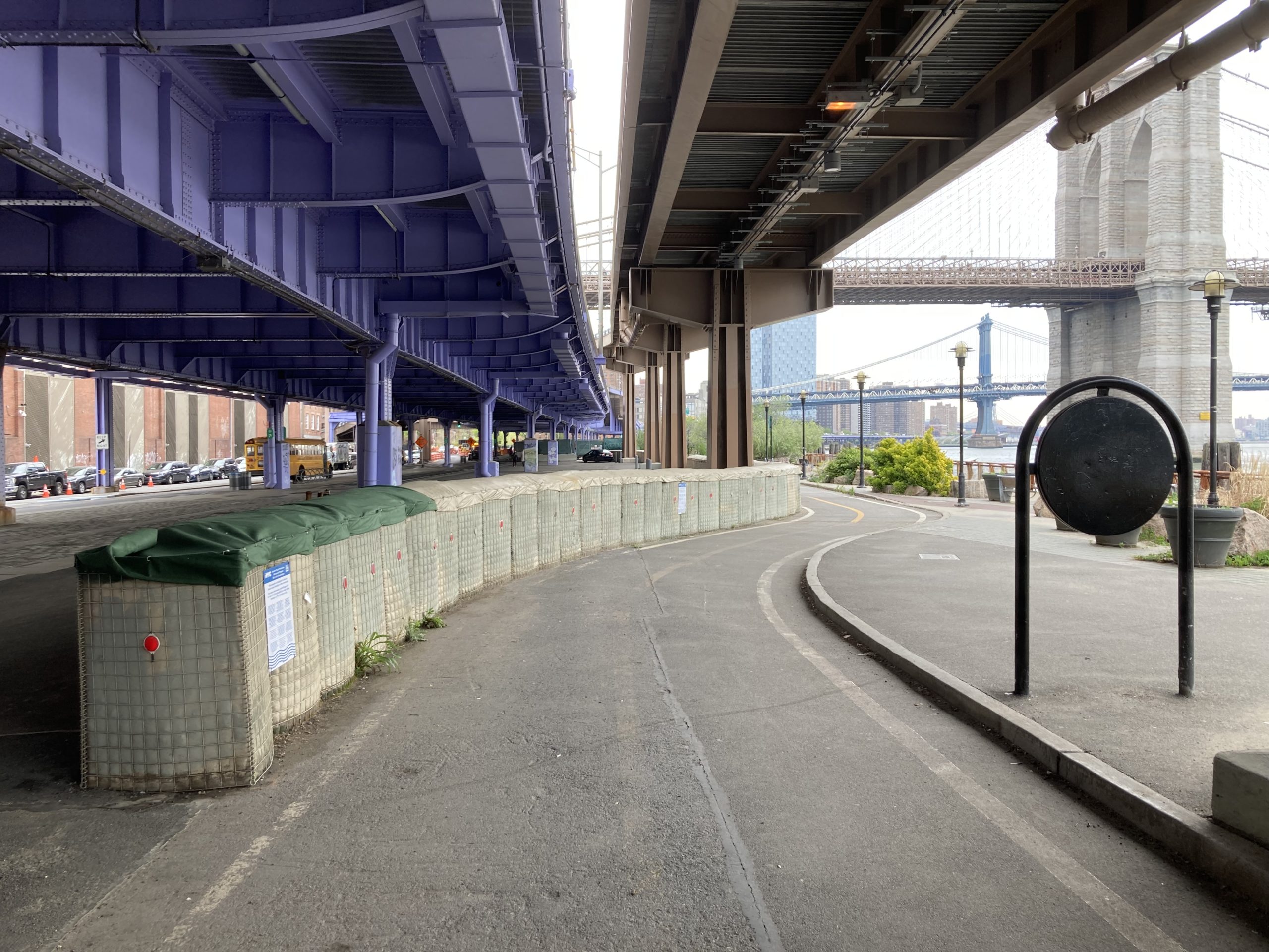
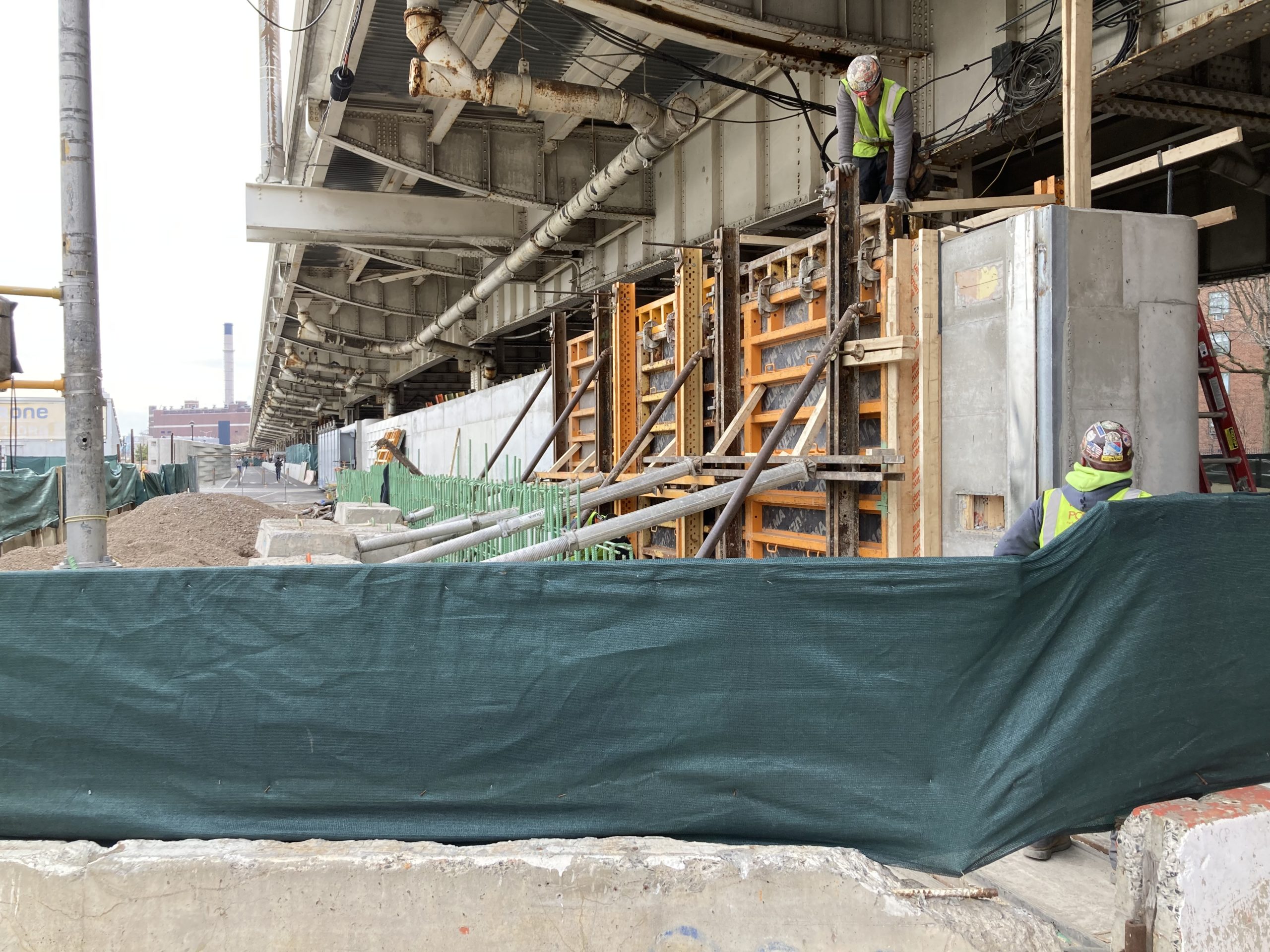
Temporary Hesco barriers and construction of a new barrier wall in Two Bridges
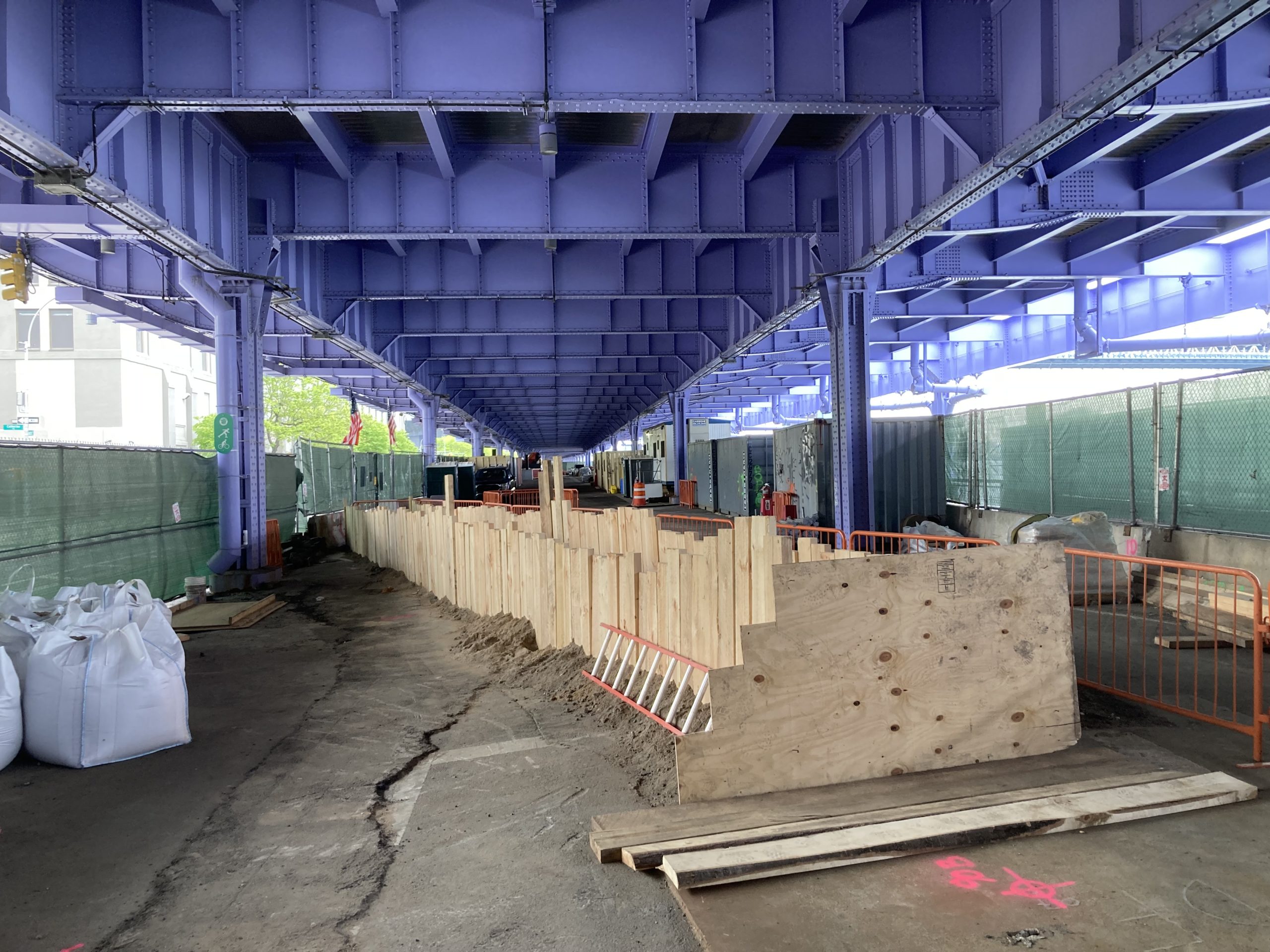
Below the ESCR lies the Brooklyn Bridge – Montgomery Coastal Resilience (BMCR). Protecting what is known as the Two Bridges area (where the Brooklyn and Manhattan bridges enter Manhattan), this section will consist of permanent and deployable flip-up barriers underneath the elevated FDR Drive, along the inland side of the esplanade running along the East River. Currently, temporary Hesco barriers have been deployed along some of this distance. As noted, construction has begun on the permanent fixtures and is expected to continue until late 2026. This section and the ones below it are technically challenging due to the elevated portion of the FDR Drive above, infrastructure below ground, and narrow space between the streetscape and water. These challenges become more severe in the next section to the south, running through the Seaport and Financial District. (See here for more details.)
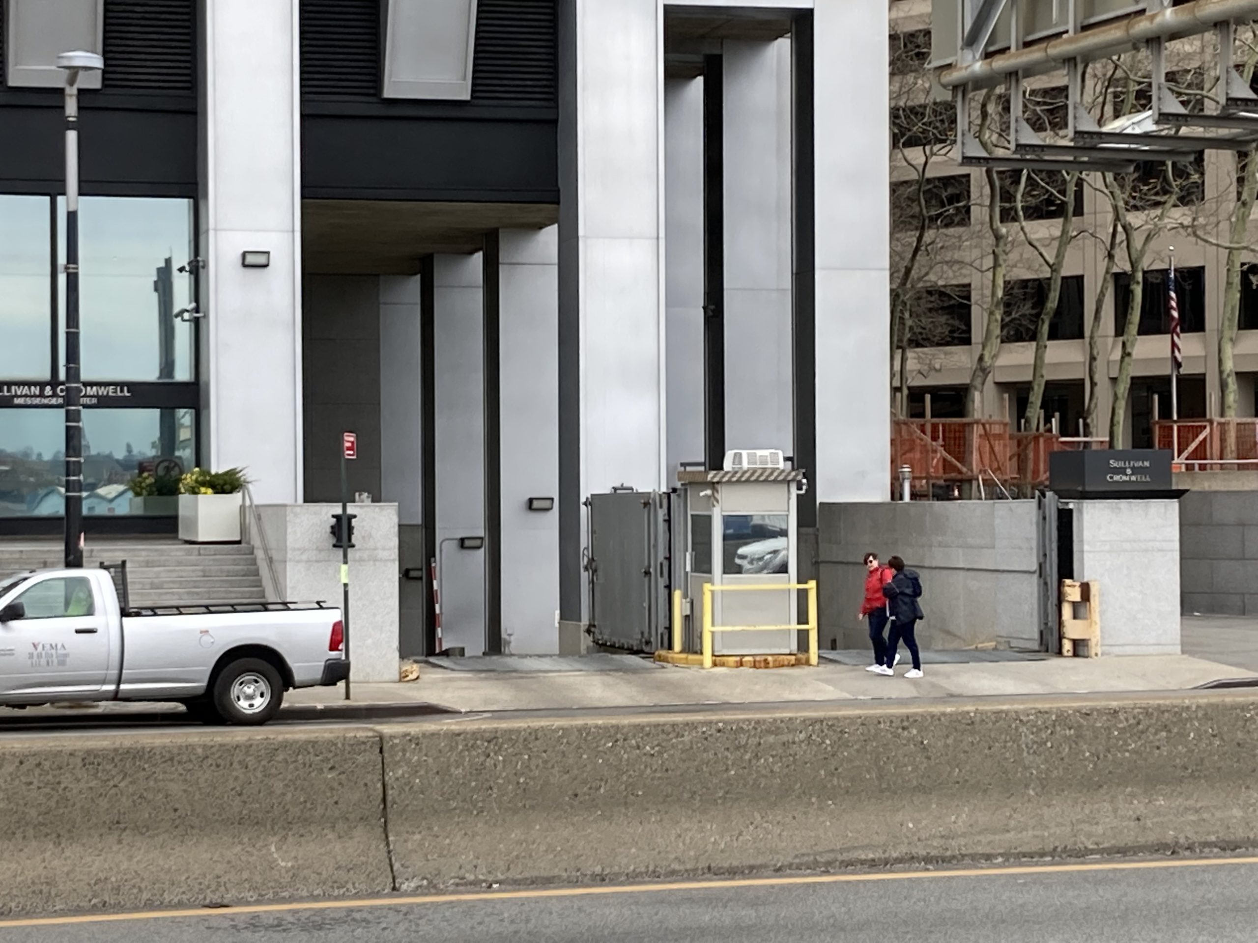
The FDR Drive in FiDi and flood barriers installed on private property (walls and gates)
The Financial District and Seaport Coastal Resilience (FDSCR) is especially challenging for several reasons. First, the northern part consists of the South Street Seaport, which, by its nature, must be open to the water. Below that, the FDR Drive descends to street level, limiting overhead space, the streetscape comes right up to the water, and there are tunnels and other critical infrastructure below the entire section. Finally, the southern end is anchored by the Staten Island and Governor’s Island ferry terminals, which also must be open to the water. The NYC Economic Development Corporation (EDC) and the Mayor’s Office of Climate Resiliency (MOCR) recently released The Financial District and Seaport Climate Resilience Master Plan, which outlines an innovative design proposal to extend the shoreline out into the East River by up to 500 feet (about 150 meters). Rather than simply adding landfill, which has been the usual method up to now, the project would create a complex, multi-layered shore defense consisting of raised features to protect against high water, provide parkland amenities, enhance the East River natural environment, improve accessibility, harden the Seaport and ferry facilities, and install resilient stormwater infrastructure inland to protect the streets behind the new defenses from flooding, since they are actually lower than the existing coastline. They are currently working to finalize the exact footprint of the project and assess the regulatory impact of the plan, and they expect to have two alternative proposals for final stage development by August 2023. They are also working to include sustainable or green elements such as use of carbon sequestering concrete. Because this is a massive undertaking, it is currently projected to cost at least $5-$7 billion and take 15 to 20 years to complete. In the meantime, smaller, ad hoc temporary flooding measures are being deployed, often by property owners in the neighborhood. (See here and here for more details.)
The Battery Promenade and the Battery Playscape
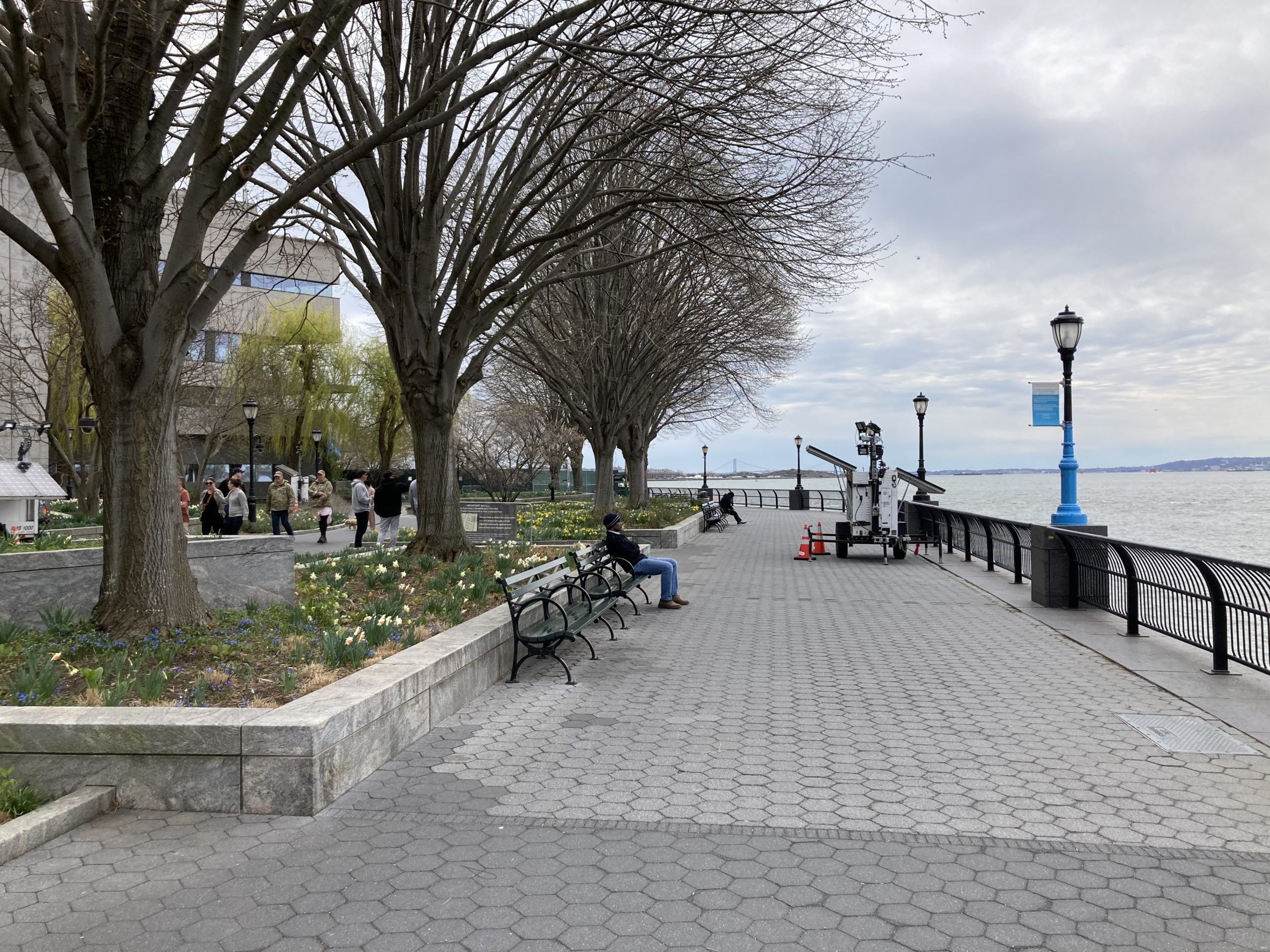
The FDSCR connects to The Battery Coastal Resilience (BCR) on its southern / western end. The BCR will raise the promenade along the shore by about six feet (approximately two meters) and will include changes to the park to make it more resilient to saltwater incursion, with salt-tolerant plantings, improved drainage, and hardened infrastructure. The first element of this hardened infrastructure is the Battery Playscape, a playground designed to serve as green infrastructure to divert flooding into underground tanks and to be resilient against saltwater incursion and Combined Sewer Overflow (CSO). Eventually, raised features will also need to be constructed along the inland side of the park to protect against major storm surge, but those elements are not included in the current project. The storm surge protection along the inner boundary of Battery Park will actually consist of extensions from the FiDi section that will extend along the eastern edge of the park from the ferry terminals, connecting with another section extending out from the Wagner Park section of the Battery Park City project described below. The EDC says they may have a design by fall 2023. The current phase of construction on the promenade will be conducted in two parts and is projected to be completed sometime in 2025. Reconstruction of the bulkhead is already underway on the southern half of the site. The apparently unresolved element to this section is the Coast Guard building sitting between the Battery Promenade and the Staten Island Ferry Terminal. This is federal government property, and the occupants have reportedly refused to cede the land for inclusion in the resilience efforts or redevelop it themselves. As long as this situation continues, Battery Park will remain exposed to the harbor through this gap. (See here and here for more details.)
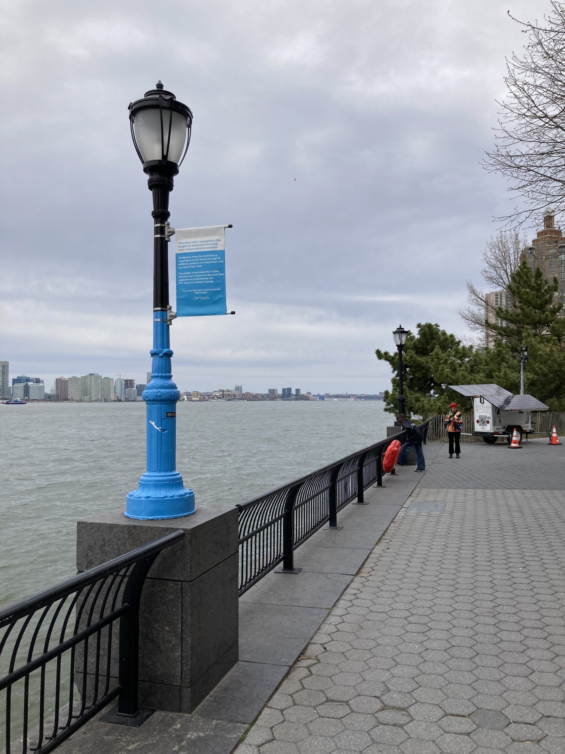
The southern Battery Park City Promenade. The blue marks the projected high water mark for storm surge by 2050.
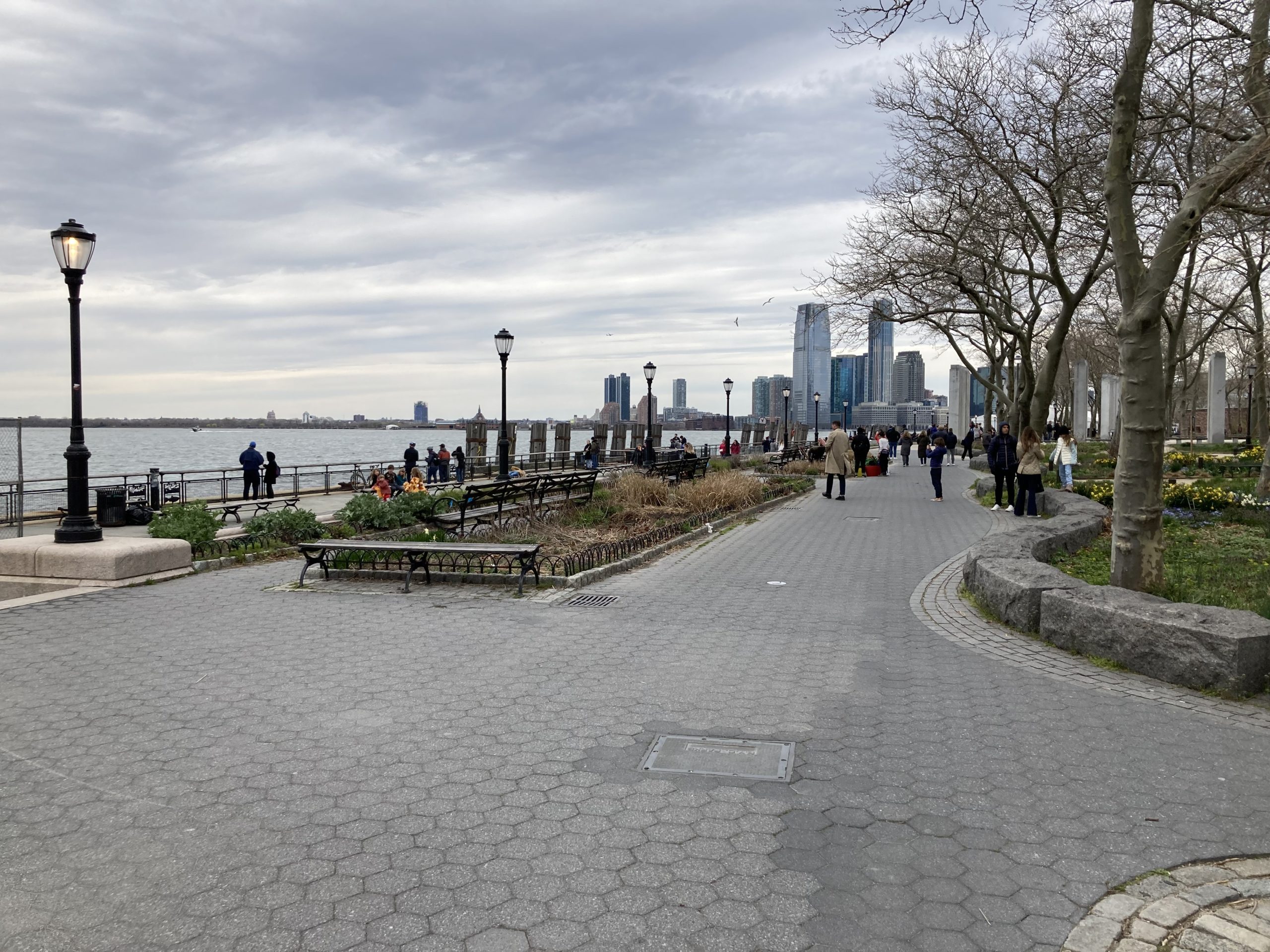
North from the BCR up the Hudson River is the Battery Park City Resiliency (BPCR), which consists of three sections: 1) The South Battery Park City Resiliency Project; 2) The North/West Battery Park Resiliency Project, and; 3) The BPC Ball Fields & Community Center Resiliency Project. Each of these will include barriers and raised features and, at least around the ball fields, enhanced water removal infrastructure to protect that low-lying area behind the coastal defenses. There are three sections because of the different nature of the challenges in these three zones. The southern section involves raising Wagner Park and flanking it with a series of floodwalls and barriers to protect the greenspace and buildings above the northern edge of Battery Park. This is the section that will eventually connect with the FiDi project, described above. The Wagner Park project will connect to the section further north, which is more built up, with a narrow band of parkland and a marina along the Hudson River, and buildings close to the water’s edge in many places. The ballfields are inland and separate from the coastal defenses, but flooded badly during Sandy because they lie so low. Work here is apparently largely completed. Construction had begun on the Wagner Park section, but was halted when area residents filed a lawsuit, which is currently still in litigation. (See here for more details.)
The area above the BPCR is included in the U.S. Army Corps of Engineers Harbors and Tributaries Study (USACE HATS). This study was temporarily suspended due to lack of funding but resumed its work in 2019 and released a set of five alternative proposals in late 2022. HATS originally attracted a lot of attention for its most dramatic proposal, Alternative 2, which proposed to build massive flood barriers like those protecting Venice that would entirely seal off New York Harbor if a storm approached. The larger one would run on-land and in-water from Long Branch, NJ, to Far Rockaway, NY, and the smaller across the Throgs Neck narrows in the Long Island Sound. This was ultimately rejected, however, in favor of its Tentatively Selected Plan (TSP), which is the recommended proposal. This just concluded its public comment phase (which was supposed to end March 7th but was extended until March 31st) and will now move on to the next set of reviews. The intention is to issue a feasibility report by early 2024 and a final Chief’s Report by summer 2024. That would then be submitted along with a funding request to Congress in 2025. If approved, construction could run from 2030 through 2044.
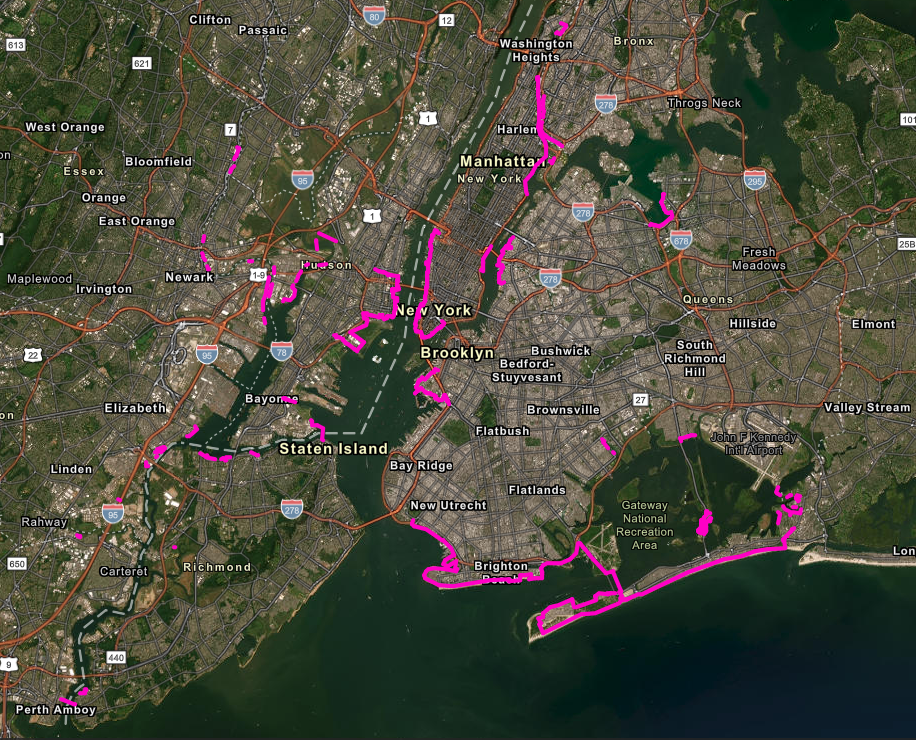
USACE HATS Story Map for Alternative 3B
The TSP is titled “Alternative 3B: Multi-Basin Storm Surge Barriers with Shore-Based Measures”. It would consist of massive surge barriers in the water protecting the larger bays and waterways on either side of the Hudson and East Rivers along with onshore flood walls and raised features around the coastline from the Rockaway Peninsula to Flushing Bay in the east and up the Hudson River and Newark Bay in the west, including extensive sections of the lowlands between Jersey City and Newark in the New Jersey Meadowlands. As noted above, in Manhattan there is some overlap in the proposed design with currently ongoing ESCR and LMCR projects, but most of Alternative 3B would cover areas beyond these, going up to 42nd Street on the East Side of Manhattan and 34th Street on the West Side. It was selected from among the five alternatives through analysis of projected benefits and costs for each plan and comparing their Benefit Cost Ratio. Alternative 3B was determined to have the most “bang for the buck”, delivering relatively more benefits at relatively less cost. Currently, this plan is estimated to cost approximately $52.7 billion, although that is sure to rise. (See here, here, and here for more details.)
Each of the coastal resilience plans includes elements to defend against sea level rise as well as worst-case storm surge flooding, since even by 2080 models predict significant “sunny day” flooding of low-lying areas around the city due to rising seas and sinking land mass. This is why the plans often have primary defenses to allow for higher normal water levels along with secondary defenses to protect against storms, even if at the expense of some parkland or other areas experiencing saltwater flooding. One of many public concerns about the HATS proposals is that they only focus on storm surge and do not take sea level rise or CSO into account. There are a number of other issues with the proposals, and these will have to be dealt with over the course of the feedback and review process, which will continue until at least June 2024.
There are also two major projects around Staten Island. One is the Living Breakwaters offshore project, which consists of building artificial shoals seeded with oysters, to help restore the native ecosystem and dampen the force of waves and tidal surges against the shoreline. This project is currently under construction. (See here and here for more details.)
The second is a managed retreat from the shoreline in certain areas. Properties in the Oakwood Beach neighborhood have been bought up by New York State and demolished in an effort to remove people from this area that was heavily damaged during Superstorm Sandy, with three fatalities and many homes completely destroyed. Almost all homeowners in the area have sold their properties, although there are still a few holdouts. (See here and here for more details.)
The best single place to go for information on all these projects is the Rebuild by Design website. If you go to the News & Events tab and look on the Events and Updates pages you will find a lot of the information I’ve summarized above along with links to these and other resources.
It has been slightly over ten years since Superstorm Sandy hit the region. Incredible progress has been made on deciding how to address issues arising from climate change and the increasing dangers posed by water to New York City and its surroundings from storm surge. However, with decades of work still to do, most areas continue to be exposed to danger, since any gap in storm surge barriers leaves an area open to flooding, and the completion of a continuous line of defenses around Manhattan and other areas is still years, if not decades, away.
Matthew Gillam
Senior Researcher
April 29, 2023