

Superstorm Sandy hit the New York region on October 29, 2012. Although it had been downgraded from a hurricane, in the Five Boroughs alone it damaged or destroyed tens of thousands of buildings, paralyzed services, claimed 44 lives, and submerged large areas of coastline. The cost from damage and lost economic activity is estimated to be around $19 billion.
In the years since, the MTA, ConEd, Verizon, and other service providers have worked diligently to restore and upgrade infrastructure and improve its resilience and survivability. This has taken place across the city, but the most ambitious elements of this effort cover the coastline of the lower quarter of Manhattan, the heart of New York City’s (and New York State’s) economy.
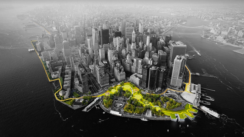
The first step in figuring out how to strengthen New York City’s ability to withstand future events like this was the Rebuild by Design competition, launched by President Obama’s Hurricane Sandy Rebuilding Task Force. After an initial phase of research and development, teams presented their proposals for improving resiliency in April 2014, and the team led by Bjarke Ingels Group was chosen the eventual winner of this competition for their BIG U concept, consisting of what they term “social infrastructure and hedonistic sustainability.” The fundamental concept behind this is to develop means of flood protection that also enhance quality of life and social infrastructure, such as berms that serve as parks and buildings that double as seawalls (http://www.rebuildbydesign.org/our-work/all-proposals/winning-projects/big-u).
The BIG U, as originally conceived, was a combination of fixed and movable barriers, buildings, and berms, all designed to enhance the urban environment in normal times and shield it from storm surges and flooding in emergencies. This approach has evolved in its details as the particular characteristics, requirements, and limitations of each neighborhood have become more apparent.
Although described as covering the vulnerable shoreline extending from West 57th Street down and around to East 42nd, the currently proposed mitigation projects do not cover this entire stretch.
What were three zones around Lower Manhattan with somewhat different approaches in the original proposal have expanded to seven zones now. From the West Side, along the Hudson River, there is the West Side Highway and Tribeca, then Battery Park City, the Battery, the Financial District, the South Street Seaport, and the Two Bridges neighborhood. Above this is the East River Park, and above that is the 34th Street area that also flooded badly during Sandy, knocking out three major hospitals located there. This last section, however, is not included in any current planning. The East River Park section has been renamed the East Side Coastal Resiliency (ESCR) and the sections around Lower Manhattan collectively are the Lower Manhattan Coastal Resiliency (LMCR).
According to the Economic Development Corporation (EDC), some sections of the project are currently up for bidding, restricting their ability to discuss the overall project. The EDC’s Lower Manhattan Climate Resilience Study, released in March 2019, details the issues in Lower Manhattan, projected effects of climate change, a toolkit of ways to address these, and the proposals for applying these that have been created in line with the original BIG U concepts.
As mentioned, each section will adopt a different approach to flood prevention. The West Side Highway / Tribeca area can be protected by a combination of fixed barriers utilizing raised features such as berms and planters, gaps in which can be blocked by deployable barriers when flooding threatens. At the moment, this section is included in the US Army Corps of Engineers Harbor and Tributaries Study (HATS), which is still in the research and public input stage.
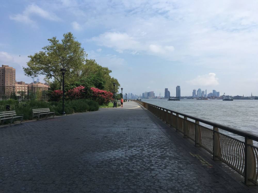
The Battery Park City section is being overseen by the Battery Park City Authority (BPCA). Work here is divided into four interrelated projects running from the northern perimeter above Stuyvesant High School and Rockefeller Park, along the western shore through the park, down past the Museum of Jewish Heritage on Pier A and extending along the northern edge of Battery Park, with the fourth area securing the BPC Ball Fields, which sit at a geographic low point and are particularly susceptible to flooding. $134M in bonds have been approved for these sections.
The BPCA section, as described, would extend all along the northern edge of Battery Park (“the Battery”). It’s been reported that the EDC, Parks, the BPCA, and the Battery Conservancy are working on a plan to raise the waterfront esplanade in Battery Park and install a berm toward the back of the park linking with the BPCA berm in order to help protect against rising sea levels and storm surges while preserving the character of the park. In speaking with the Battery Conservancy, however, it appears there is no solid plan yet developed for how to protect this section of the shoreline, with jurisdictional, financial, and practical challenges hampering progress.
The BIG U also proposed building what they termed a “reverse aquarium” near the ferry terminals, which would provide cultural space as a marine museum or environmental education facility built to allow visitors to actually look out into the water, even during a storm surge. This innovative proposal will probably not be realized, both because no funding is available and because the federal government is unwilling to give up the US Coast Guard building currently occupying the proposed site. There do not appear to be any alternative proposals for what to do with this low-lying section of the Battery.
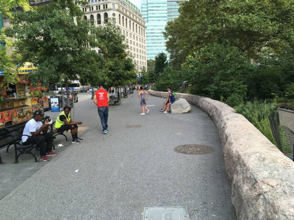
While there are many challenges to protecting the Battery, it is the Financial District (including the Staten Island Ferry and Battery Maritime Building) and South Street Seaport that are in some ways the most problematic sections. They sit very low to the water, are densely constructed above (especially with the FDR Drive where it descends to street level) and below ground, and have almost no open space on which to construct flood protection, severely limiting deployment of either movable or fixed barriers. The ferry terminals and Seaport have the added issue that, being facilities for boats, they must by necessity be exposed to the water. Altering that relationship alters their fundamental nature and ability to function. The only viable option here would be barriers between the dock facilities and the street grid, but since the city presses up closely against them there is very little space to work with.
In FiDi, the City is proposing to extend the shoreline outward up to 500 feet, creating new land that will act as a buffer against high water and provide space for development. Whether that would include parks, buildings, or other amenities is still an open question. The Request For Quote (RFQ) submission process ended in May 2019, although the results have not yet been announced (as of late November).
Property owners in Lower Manhattan are said to be taking their own measures throughout this area, including deployable barriers, to harden their buildings against flooding in the expectation there will be no City-led project to protect them for the foreseeable future. This is on top of code changes the City mandated following Sandy to do things like move vulnerable equipment out of basements to higher floors and provide access to gravity-fed water in common areas on lower floors for residents living on upper floors, who require electric pumps to provide water to their units.
The Two Bridges area is slated to receive a combination of flood walls and deployable barriers that would be flipped up into position when needed. While this section of waterfront is also narrow like the FiDi / Seaport sections, it is not as densely constructed below ground nor so constrained above, allowing the installation of movable barriers. Temporary barriers (HESCO barriers and Tiger Dams) are being put in place from Wall Street up to around Catherine Slip in between the Brooklyn and Manhattan Bridges as a contingency, until permanent ones can be installed.
The East River Park section of waterfront has received considerable attention over the past few years, first for the extensive efforts there to engage the community in developing a flooding mitigation strategy for the park and the large public housing communities behind it, and then for the City’s sudden reversal of those outcomes late last year and imposition of a new, costlier plan with no public input, which will radically reshape the park and the community’s interaction with it.
This is perhaps the section causing the biggest headaches for the City and exemplifies both the advantages and potential pitfalls of the public engagement process. City officials have defended the changes to the plan developed in cooperation with residents of the two community boards affected, but such a radical change of plan so late in the process without any prior warning ignited a firestorm of opposition that severely hampered even considering the merits of the new versus the old proposals.
The Parks Department and Department of Design and Construction (DDC) were originally working with the community toward a proposal to construct a berm along the FDR Drive toward the western edge of the park that would provide flood protection while retaining much of the existing infrastructure and flora. Considerable individual and community group effort had gone into restoring and improving the park over the years, including renovating facilities and planting thousands of flowers, as well as giving attention to the hundreds of trees there, and the community is understandably deeply emotionally invested in the park as it now exists. Residents have pointed out that the park also provides a vital transportation corridor for bicyclists in an area lacking good public transit, besides containing two ferry terminals, and provides the major greenspace and recreational facilities for an area that has no other large parks, not to mention private yards or school grounds.
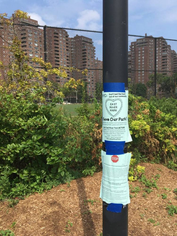
The new proposal essentially calls for removing everything there now, adding eight to ten feet of new soil, and building a new park on this elevated land. According to the City, it conducted a review of the proposals developed through the community consultation process, where its engineers determined that the bulkhead along the river is failing and will need to be replaced in any event, and that the park, because of its facilities, is ill-suited to be a buffer space that can accommodate saline flood water and keep it from inundating the residential areas inland, before allowing it to eventually flow back out once the river returns to normal. This plan would also allow earth to be brought in by barge rather than by truck, and the City contends it would avoid shutting down one lane of the already strained FDR Drive for up to five years and would move most of the construction away from the public housing just across the FDR from the park. For residents, however, the new plan simply meant destroying the one substantial green space they have, shutting them out of it for years, and then leaving them with essentially a desert that would take decades to recover. The fact that this was not a possibility on the table from the beginning only made that prospect worse. These issues are exacerbated by concerns about issues like soil contamination, short and long term problems for the public housing development there, questions about the ultimate efficacy of the flood protection, and harm to the ecosystem and the many species of birds and other wildlife that inhabit the space.
It is unclear why exactly the City failed to consult with the people who had been working on the original design proposal before announcing their revised plan, but the fallout from that is still overwhelming. According to an official at the Parks Department, the City’s review process brought to light various concerns about the constructability of the berm proposal that they considered to be merely engineering issues, and as such they did not see these as part of the community input process. Commissioner Silver of the Parks Department and First Deputy Commissioner Jamie Torres Springer of DDC have publicly acknowledged this process was not handled as well as it could have been.
After over a year of local opposition and review by various stakeholders, the City Council approved a modified version of the plan in mid-November 2019. This plan will be implemented in phases, keeping approximately half the park open at any time, and will take other actions to mitigate the impact on the community. These include the construction of a new park at Pier 42 at the south end of East River Park and the upgrading of other parks and public spaces throughout the neighborhood. The DDC says the park will remain entirely open until fall 2020 and from then until spring 2023 42 percent of the park will be open. During this time the new Pier 42 park should also open. Then, from summer 2023 to late 2025 50 percent of the park should be open. Flood protection systems should be ready for hurricane season 2023, and all work should be finished by late 2025. This plan has not won over everyone, but did gain the support of the various politicians and community boards representing the area, while they also urged the City to implement a number of recommendations to address concerns made by an independent consultant hired to review the plan.
The City apparently has no plans for the uppermost section on the East Side, from above Stuyvesant Cove Park (which is included in the plans for the ESCR) to around 34th Street. The hospitals themselves have invested considerable money and effort into hardening their facilities against future flooding, and because the land slopes upward fairly quickly from the shoreline those measures seem to be considered adequate. The Veteran’s Administration Hospital that sits on what will be the northern edge of the ESCR constructed a flood wall estimated to provide 500-year flood protection, as well as relocating vulnerable plant and facilities to higher floors. The other four affected hospitals have implemented similar improvements.
Matthew Gillam
December 2019